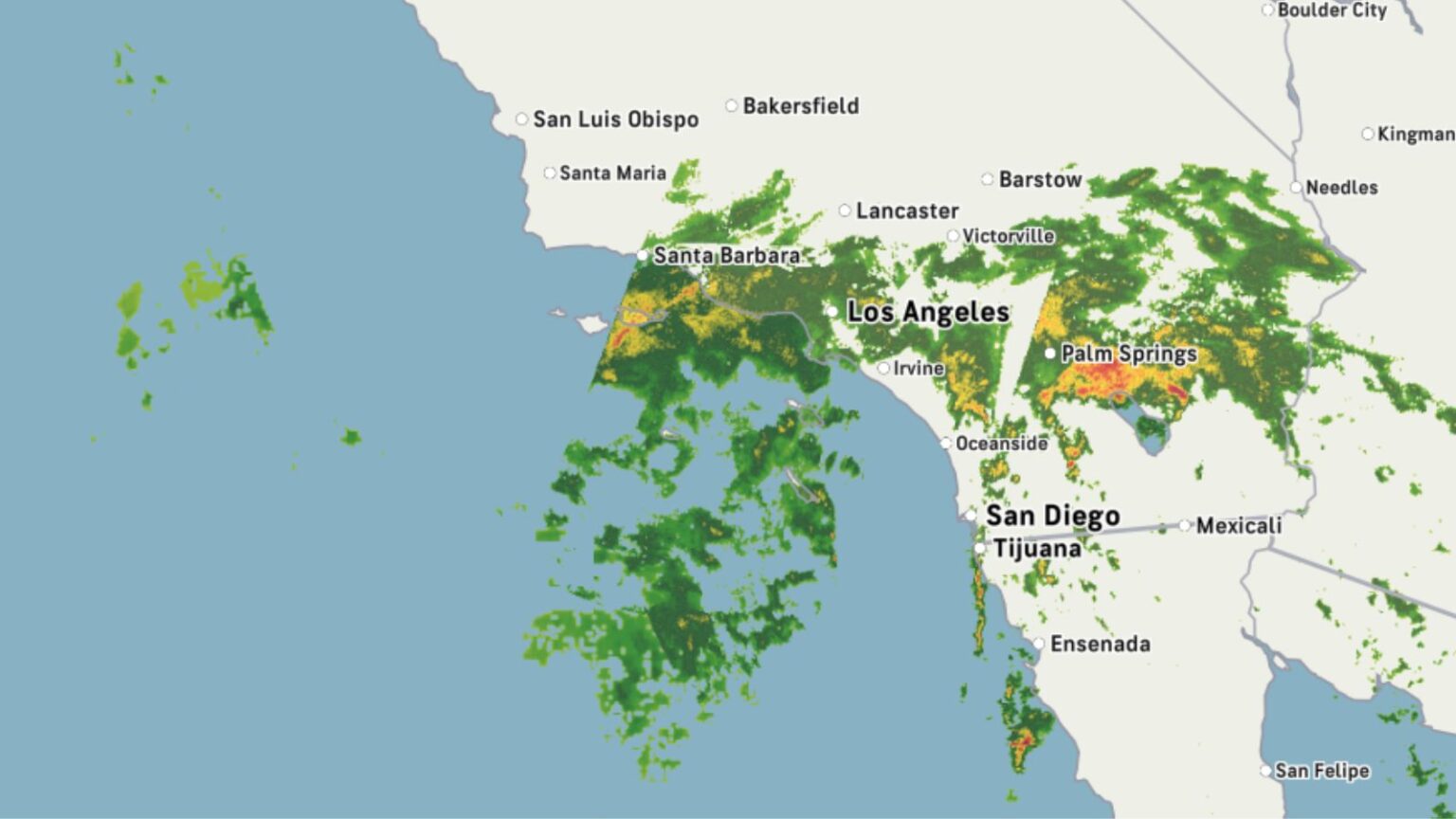
An atmospheric river sweeping through California has prompted the National Weather Service to issue flood watches for vast portions of the state, including the North Bay, North Coast, and Sacramento Valley.
Millions of residents are now facing heightened flood risk, as intensified storm activity threatens vulnerable communities with flash flooding and property damage.
Newsweek contacted the National Weather Service for more information.
Why It Matters
About 1.4 million Californians live in areas with a high likelihood of annual flooding, according to the California Department of Water Resources. These risks are escalating with more severe storms fueled by climate change, raising the stakes for infrastructure planning and emergency preparedness.
What To Know
The latest data from the National Weather Service issued warnings in several southern California areas.
The service said that there were flood warnings for the Apple and Lucerne Valleys, Coachella Valley, Riverside County Mountains, San Bernardino County Mountains, and San Diego County Deserts, along with the San Diego County Mountains and San Gorgonio Pass near Banning.
In these regions, the service said that “excessive runoff may result in flooding of rivers, creeks, streams, and other low-lying and flood-prone locations. Low-water crossings may be flooded.”
“Scattered showers and thunderstorms will spread northward across the area today with the most likely time for more widespread and heavier rainfall from the morning through early evening.
“Some thunderstorms may produce locally heavy rainfall, which may lead to flooding. The most likely peak hourly rainfall is one-half to one inch with isolated maximum hourly rainfall to 2 inches.”
What People Are Saying
In their latest forecast discussion for the region, the National Weather Service said: “Post-tropical Mario continues to bring some tropical moisture near southern coastal California, promoting the possibility for locally heavy thunderstorms today and Friday across California.
“Rainfall totals are expected to reach 1-3” and rainfall rates >1″/hr, and there is a chance for flash flooding in sensitive terrain and localized urban flooding.
“Flash Flood Watches have been issued for most of southern California; follow your local weather forecast office for specific information. New Mexico and Arizona will also see an increase in showers and thunderstorms and a possibility for localized flash flooding today into Friday.”
What’s Next
Authorities are urging residents in flood-prone zones to monitor alerts, avoid low-lying areas, and consider flood insurance even if their properties lie outside FEMA-designated zones. With the gap between predictive models and regulatory maps now exposed, pressure is building on municipalities and state agencies to modernize infrastructure and flood mitigation planning.
Read the full article here


