Parts of Sydney were hit with brief but intense bouts of rain on Friday afternoon as a storm front moved rapidly across the NSW coastline, threatening heavy gusts, hail and power outages for large parts of the state.
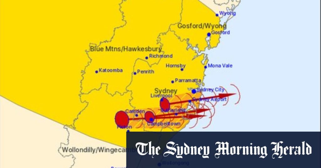
The Bureau of Meteorology issued a severe thunderstorm warning for Sydney and the Blue Mountains, the Mid North Coast and Hunter, as well as the Central Tablelands and the state’s Central West.
Heavy rainfall was predicted for Sydney on Friday afternoon.Credit: Kate Geraghty
A warning for large hailstones and damaging winds was in place for the Greater Sydney area, with the Central Coast, Blue Mountains and the area around Sydney airport most at threat.
Temperatures dropped from a high of 31 degrees to the mid-20s by the early afternoon, after the Bureau forecast it could drop by as much as 10 degrees in half an hour.
Bureau meteorologist Angus Hines said a powerful storm which developed over the airport in the city’s south was one of four or five storms bringing wild conditions as they moved quickly across the city.
“It’s hard to pinpoint which suburbs will get wet and which won’t but … a lot of places will get it and then 10 minutes later it’ll be gone,” he said. “It’ll be over the ocean before you know it.”
The city’s highest rainfall was recorded at Cronulla South Bowling Club, which copped 9 millimetres in the hour before 5.15pm.
Hines said the risk of severe storms was likely to disappear after 7pm, but the stormy weather could continue further north “well into the night and possibly into tomorrow morning”.
Power outages and damage to trees, roofs and fences were possible “as those winds really race through”, he said.
Read the full article here


