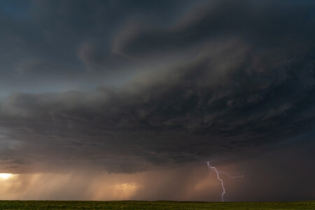
Mid-September brings peak hurricane season for the Atlantic Ocean, but there are currently no tropical storms or hurricanes. Earlier this week, a meteorologist addressed one of the reasons why the season is experiencing a lull.
Why It Matters
The Atlantic hurricane season began on June 1 and will last through November 30. Earlier this year, National Hurricane Center (NHC) meteorologists predicted an above-average season.
As of September 10, there have been six named storms that have formed in the Atlantic, including one hurricane. During a quiet period earlier this summer, meteorologists urged people to remain vigilant, stressing that peak hurricane season doesn’t typically occur until mid-September.
Peak hurricane season has arrived, but the Atlantic remains quiet.
What to Know
One factor contributing to the lack of storms is the wind shear, WFLA chief meteorologist Jeff Berardelli said.
“All hail wind shear!!! It’s like a buzz saw for hurricanes,” Berardelli posted on X, formerly Twitter, on Tuesday. “And it’s all over the Atlantic cutting storms off even before they get going. That’s one reason it’s quiet now and it should stay this way for the next ten days. Now what would be nice is if we could keep the shear in place the rest of the season! Who’s with me?? Fingers crossed!”
All hail wind shear!!! It’s like a buzz saw for hurricanes. And it’s all over the Atlantic cutting storms off even before they get going. That’s one reason it’s quiet now and it should stay this way for the next ten days.
Now what would be nice is if we could keep the shear in… pic.twitter.com/2kAVnKkjYV— Jeff Berardelli (@WeatherProf) September 9, 2025
In a later post on X, Berardelli explained that an “extremely amplified jet stream” is powering the strong wind shear, as well as early-season cold fronts in the Gulf.
“It has thrown the whole Northern Hemisphere weather off-kilter,” Berardelli posted. “That means cool-dry weather this weekend for North-Central Florida about a month early! It also means hurricane killing wind shear across the Atlantic Basin!”
Despite there being no storms in the Atlantic, NHC meteorologists are urging people to remain on alert.
“September 10 is the climatological peak of the Atlantic hurricane season. It’s been relatively quiet in the tropics lately, but in this video, Senior Hurricane Specialist Brad Reinhart and Hurricane Specialist Andrew Hagen explain how 60% of activity typically occurs after September 10, and that our attention starts to turn toward the western part of the basin as we head into late September and October,” NHC posted on X with a video.
Newsweek reached out to the NHC by email for comment.
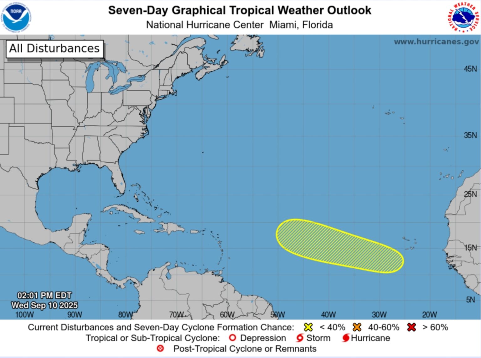
There is one disturbance in the Atlantic Ocean as of Wednesday, which has a low chance of strengthening into a tropical storm in the next seven days.
What People Are Saying
Berardelli in a post on X: “Here’s the science: Warm air is being forced all the way up to the Arctic circle by an elongated jet stream. That will cause an “Omega block” to form this weekend over Central Canada – you can see the Greek Omega shape with cold air on either side. These “blocking” patterns are very tough to dislodge. Because what goes up, must come down, cool air is being forced south along the Eastern Sea Board bringing Faux Fall to Florida. Faux or not, we will take it!”
NHC in an update about a new disturbance in the Atlantic: “A tropical wave is forecast to emerge offshore of west Africa in a couple of days. Environmental conditions could support some slow development of the system over the weekend into early next week as the wave moves to the west-northwest at about 15 mph over the eastern and central tropical Atlantic.”
What Happens Next
Despite there being no named storms in the Atlantic, people in hurricane-prone areas are urged to remain on alert throughout the remainder of the season.
Read the full article here


