


Residents across parts of Texas are facing a dangerous overnight mix of severe thunderstorms and flash flooding, with the National Weather Service (NWS) warning of damaging winds, large hail, and life-threatening flooding.
Where the Warnings Are in Effect
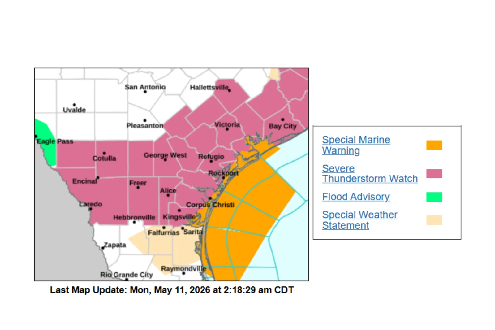
A severe thunderstorm warning remains active until Monday morning, affecting several coastal and near-coastal counties, including:
- Aransas County, including Port Aransas and Aransas Pass
- Southwestern Calhoun County
- Central Nueces County
- Eastern San Patricio County
- South-central Refugio County
- Eastern Kleberg County
The storm line, moving southeast at roughly 45 mph, is impacting cities such as Corpus Christi, Rockport, Port Aransas, Portland, and Robstown, as well as key travel corridors including stretches of Interstate 37 and U.S. Highways 181 and 77.
Meanwhile, a separate flash flood warning remains in effect, also until Monday morning, for east central Lee County, including areas near Lake Somerville State Park and Loebau.
Below is an NWS local radar map showing the movement of thunderstorms and flash flooding across the state.
What’s Happening and Why
According to the NWS, the storms could be capable of producing wind gusts reaching up to 60 mph and hail the size of a quarter (around an inch).
At the same time, slow-moving systems over Lee County have already dumped 4 to 5 inches of rain overnight on Sunday, with more expected through the early hours of the morning.
Forecasters warned that even another inch of rain could quickly worsen flooding conditions after several inches had already fallen overnight.
Potential Impacts
The NWS warns of significant risks to both property and life, including:
- Hail damage to vehicles
- Wind damage to roofs, sidings, and trees
- Flash flooding of creeks, streams, streets, and underpasses
- Dangerous travel conditions, especially at night
Flash flooding is considered life-threatening, particularly in rural or low-lying areas where water can rise quickly and unexpectedly.
Residents Urged to Avoid Flooded Roads Overnight
The NWS is urging residents in affected areas to take immediate precautions:
- Move indoors to an interior room on the lowest floor during severe storms
- Avoid travel, especially in flooded or storm-impacted areas
- Never drive through floodwaters—even shallow water can sweep vehicles away
- Stay alert overnight, when visibility is reduced, and hazards are harder to detect
- Campers and hikers should move away from streams and creeks immediately
The NWS repeated one of its core flood safety warnings to drivers: “Turn around, don’t drown,” noting that most flood-related deaths occur in vehicles.
What the Forecast Looks Like This Week
Forecasters said conditions should gradually improve after Monday morning, with a mostly warm and dry week expected across much of South Texas. Highs are forecast to remain in the low-to-mid 80s before another chance of showers and storms returns toward the weekend.
Read the full article here


